
Category: Teknik

  • How does AI know it has seen an elephant?

    How does AI know it has seen an elephant?

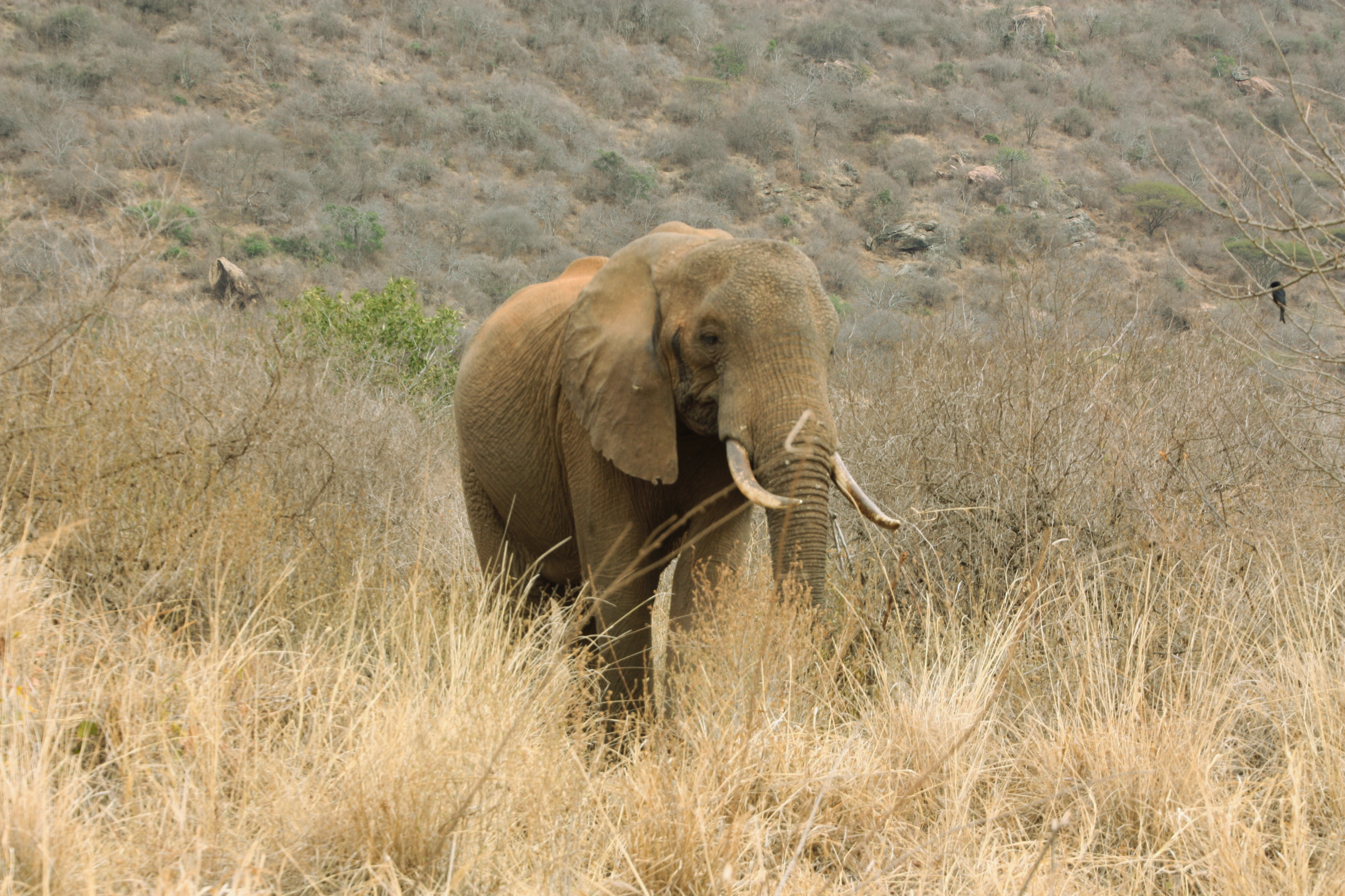
    A wildlife camera takes a photograph of an elephant.
    To us, the result is obvious. Large grey animal, trunk, enormous ears: elephant.
    But the camera doesn’t see an elephant. It sees millions of pixel values.
    Turning those pixels into the word elephant is the job of computer vision. Modern AI has
    become remarkably good at this, but recognising wildlife under real field conditions is more
    difficult than it may first appear.
    Animals may be far away, partly hidden behind vegetation or photographed at night. Images
    can be blurred. Several species can appear together. Sometimes only a small part of an animal
    is visible.
    And sometimes the animal is something the AI has never learned to recognise at all.

    First, find the animal
    Before trying to identify a species, Qulinda first needs to determine whether there are animals
    in the image and where they are.
    Our pipeline uses an animal detector based on MegaDetector, further adapted to the
    environments where Qulinda operates. It draws a bounding box around each detected animal
    so that subsequent analysis can concentrate on the relevant part of the image.

    But even before that, we check image quality. A badly blurred photograph may simply not
    contain enough information for reliable identification.
    This is an important principle throughout the pipeline:
    Good AI should know when the evidence is poor.
    From animal to species
    Once an animal has been detected, another model attempts to determine its species.
    Training such models requires enormous numbers of examples. Qulinda’s models have been
    trained using millions of wildlife images from different sources, including hundreds of
    thousands of images collected through our own work in the field.
    This matters because real wildlife-camera images look very different from perfect
    photographs of animals on the Internet.
    The system must learn elephants from above and behind, buffalo in darkness, partially hidden
    animals and all the other imperfect images that cameras actually produce.
    But even a good classifier can make surprising mistakes.
    Does the answer make sense?
    Suppose a photograph contains a herd of buffalo. The classifier identifies animal after animal
    as buffalo – but decides that one in the middle of the herd is a lion.
    It is possible.
    But it is also a reason to be suspicious.
    Qulinda can use the other animals in the scene as additional information. We call this a herd
    prior. Classification is no longer based entirely on each animal in isolation; the context helps
    us judge which answer is most plausible.
    There is another source of information: time.
    Wildlife cameras often take several photographs in rapid succession. If we can track the same
    animal between images, we get several opportunities to classify it. Instead of trusting one
    prediction, Qulinda can fuse the probabilities from multiple images to reach a more
    reliable result.
    Several imperfect observations can together provide strong evidence.
    What if the AI doesn’t know?
    There is an even harder problem.

    Imagine that the camera photographs a species that wasn’t represented when the classifier was trained. A conventional classifier may still confidently select whichever known species happens to look most similar.
    That can produce a very precise answer that is completely wrong.
    Qulinda therefore includes an out-of-distribution model designed to detect cases where an
    observation does not fit sufficiently well with the species the system knows.
    In that situation, we would rather report:
    Animal
    than confidently report the wrong species.
    Knowing when not to make a classification is an important part of making AI useful in the
    real world.
    From photographs to observations
    The result of the Qulinda vision pipeline is not simply a label for an entire photograph.
    Individual animals can be detected, located within the image and classified, each with its
    associated evidence.
    The original photographs are preserved, while the resulting information is stored and can be
    processed together with time, location and other observations.
    That changes what a wildlife camera can become.
    Instead of asking someone to inspect thousands of photographs, the system can help answer
    questions such as what species was observed, where and when?
    A camera captures pixels.
    AI turns those pixels into possible animals and species.
    And a carefully designed pipeline decides when there is enough evidence to trust the
    answer.
    That final step may be the most important one.

  • Can a position tell us how an animal is doing?

    Can a position tell us how an animal is doing?

    By comparing an animal’s movements with its usual behaviour, positioning data can help identify changes that deserve attention. It is a step towards making everyday animal supervision more informed.

    A position tells us where an animal is.

    But what happens when we collect positions throughout the day—and compare today’s movements with how that particular animal normally behaves?

    A cow that usually moves several kilometres a day but has barely moved today may need extra attention. So might an animal that suddenly becomes unusually active. Neither observation necessarily means something is wrong, but both can provide useful signals to the person caring for the animals.

    This is the idea behind activity analysis: turning positions into information that can support everyday supervision.

    From positions to movement

    During the grazing season, Qulinda’s animal tags regularly record each animal’s position. In the configuration described here, positions are recorded every 15 minutes during the day and every hour at night.

    By measuring the distance between consecutive positions, we can estimate how far an animal has moved over an hour, a day or a longer period.

    This is an estimate, rather than a measurement of every step. An animal may walk, turn or return to the same spot between recordings, so some movement will not be captured. Positioning accuracy can also affect the result.

    Even so, measurements collected over time can help reveal patterns that a single position cannot.

    A daily total gives us one view. Looking at movement hour by hour gives us another: when the animal was active, when it moved less, and how that pattern changes from day to day.

    What is normal for this animal?

    There is no single activity level that is normal for every cow.

    Movement depends on the landscape, weather, access to water and grazing, and many other factors. Animals are also individuals. Even within the same herd, their routines may differ.

    Instead of relying only on a fixed threshold for the whole herd, activity analysis can compare each animal with its own previous movement patterns.

    Imagine a cow whose recorded movement usually adds up to around four kilometres a day. Today, the same measurement shows only 1.2 kilometres.

    That does not tell us why the change happened. But it gives the caretaker a reason to look more closely.

    Comparing similar periods and considering conditions in the pasture helps put that change into context.

    Finding the animals that may need extra attention

    Consider a herd of 50 cattle spread across a large grazing area.

    Looking through 50 tracks on a map provides plenty of information, but interpreting all of it takes time. Automated activity analysis offers a way to highlight changes that might otherwise be difficult to spot.

    An overview could help distinguish animals moving within their usual range from those showing a marked increase or decrease in activity. An animal with very little detected movement over an extended period could be highlighted for a more urgent check.

    The practical question becomes:

    Which animals may need extra attention today?

    An overview like this can help prioritise checks and guide the caretaker to the relevant animal. It supports on-site supervision and the caretaker’s judgement.

    But did the animal really stop moving?

    Low recorded movement can have several explanations.

    The animal may have been unusually inactive. The tag may have struggled to obtain a satellite position, or poor mobile coverage may have delayed reports reaching the server. A detached collar lying on the ground could also appear stationary.

    These situations can look similar in the data, but they mean very different things.

    Reliable analysis therefore needs to consider two separate questions:

    • Animal activity: What does the available movement data suggest about the animal?
    • Tag status: Is the device providing enough reliable information to support that interpretation?

    Before interpreting a change in activity, we need to check whether the tag is reporting as expected, whether its positions are valid, and whether there are gaps in the data.

    When reliable information is missing, the result should be clear: there is not enough data to assess the animal’s activity.

    Useful insights can start with simple measurements

    Activity analysis does not always require complex artificial intelligence.

    Useful starting points include estimated movement during the last hour or 24 hours, time since the last detected movement, and differences from the animal’s usual daily pattern.

    The value comes from combining these measurements with information about data quality—and presenting them clearly.

    For example, an overview could highlight animals with unusual activity while showing where information is incomplete. A caretaker could then investigate further, comparing today’s hourly movement with previous days and inspecting the recorded positions on the map.

    The aim is to make changes easier to notice and the underlying information easier to understand.

    From tracking to supervision

    Knowing where an animal is makes it easier to find.

    Collecting positions over hours, days and weeks adds another dimension: an understanding of how that animal moves over time.

    A position tells us where the animal is. A sequence of positions helps reveal its movement pattern. Changes in that pattern can indicate when a closer look may be worthwhile.

    For Qulinda, this is the potential of activity analysis: using positioning data to support more informed animal supervision and help caretakers focus their attention where it may be needed.

  • How can satellites 20,000 km away locate an animal?

    POSITIONING

    How can satellites 20,000 km away locate an animal?

    A cow is standing somewhere in a pasture. A small battery-powered device on its collar listens to radio signals transmitted by satellites orbiting roughly 20,000 kilometres above the Earth. From these incredibly weak signals, the device can work out where the cow is, often to within just a few metres.

    Perhaps even more remarkably, the tag does not communicate with the satellites at all. It only listens.

    Measuring distance by measuring time

    The basic idea behind satellite positioning is surprisingly simple. Satellites continuously transmit radio signals containing extremely accurate timing information and information about their orbits. Since radio waves travel at the speed of light, a receiver can use the arrival times of signals from several satellites to determine its position.

    The numbers involved are extraordinary. Light travels approximately 300,000 kilometres in one second. That means it travels about 300 kilometres in a millisecond, 300 metres in a microsecond – and just 30 centimetres in a nanosecond.

    So if you want to measure distances accurately using radio signals, you need very good clocks.

    This is one reason GNSS satellites carry extremely precise atomic clocks. By listening to several satellites simultaneously, a receiver can solve for its three-dimensional position and correct for the error in its own much simpler clock. As a useful side effect, GNSS therefore provides not only position but also extremely accurate time.

    GPS is only part of the story

    We commonly call satellite positioning “GPS”, but GPS is actually the American satellite navigation system. It was the first global system to become widely used, and the name stuck – much as we use “Google” as a verb for searching the Internet.

    The more general term is GNSS – Global Navigation Satellite System.

    Today there are four major global systems: the American GPS, Europe’s Galileo, China’s BeiDou and Russia’s GLONASS. Each operates its own constellation of satellites, and modern receivers can use several constellations simultaneously. Japan and India also operate regional satellite navigation systems.

    This means that the tiny receiver in a modern phone or animal tag can listen to signals from satellites belonging to several completely independent systems.

    20,000 kilometres is a long way

    GNSS satellites orbit at around 20,000 kilometres above the Earth’s surface – more than the Earth’s own diameter. For comparison, low-Earth-orbit communication satellites such as Starlink fly only a few hundred kilometres above us.

    By the time a GNSS signal reaches the ground, it is extremely weak. The receiver must pick it out from background radio noise and determine its timing with remarkable precision.

    This is why satellite positioning works beautifully under an open sky but becomes more difficult around buildings, beneath dense vegetation or when the antenna has a poor view of the sky. Signals can also bounce from nearby objects before reaching the receiver, creating additional errors.

    Under good conditions, an ordinary modern GNSS receiver can typically determine its position within a few metres. With specialised equipment and correction techniques such as RTK, the same fundamental technology can achieve centimetre-level accuracy.

    So why don’t we put survey-grade positioning into every animal tag?

    Accuracy has a price

    For a battery-powered device, the important question is not simply how accurately can we determine the position?

    The better question is:

    How accurately and how often do we need to know the position to solve the problem?

    A surveyor may need centimetres. Someone trying to find a cow in a large grazing area usually does not.

    There is another important difference. A survey instrument can have a substantial power supply and be recharged frequently. An animal tag should ideally operate unattended for a very long time.

    Obtaining GNSS positions consumes energy. Taking positions more frequently gives us a more detailed picture of movement, but also reduces battery life. Demanding better positioning under difficult conditions can require the receiver to remain active for longer, consuming still more energy.

    Designing a good tracking system therefore involves compromises between positioning accuracy, update frequency, communication and battery life. Maximum accuracy is not necessarily the best engineering solution.

    From coordinates to useful information

    At Qulinda, a GNSS position is not the final product. It is one piece of information in a much larger system.

    A sequence of positions can tell us how an animal moves through a landscape. Positions can be related to farms, grazing areas, water sources or protected zones. The system can detect when an animal enters or leaves an area and decide when information needs to be communicated to the user.

    The challenge is therefore not simply to put a GPS receiver on an animal. It is to design the complete system around what the user actually needs to know – while making the hardware practical enough to operate for long periods in the real world.

    And all of this starts with a tiny receiver listening to clocks flying 20,000 kilometres above the Earth.